
GPS M - All new. Same FLYMASTER
GPS M - All new. Same FLYMASTER
Regular price
€560,00 EUR
Regular price
Sale price
€560,00 EUR
Unit price
per
Taxes included.

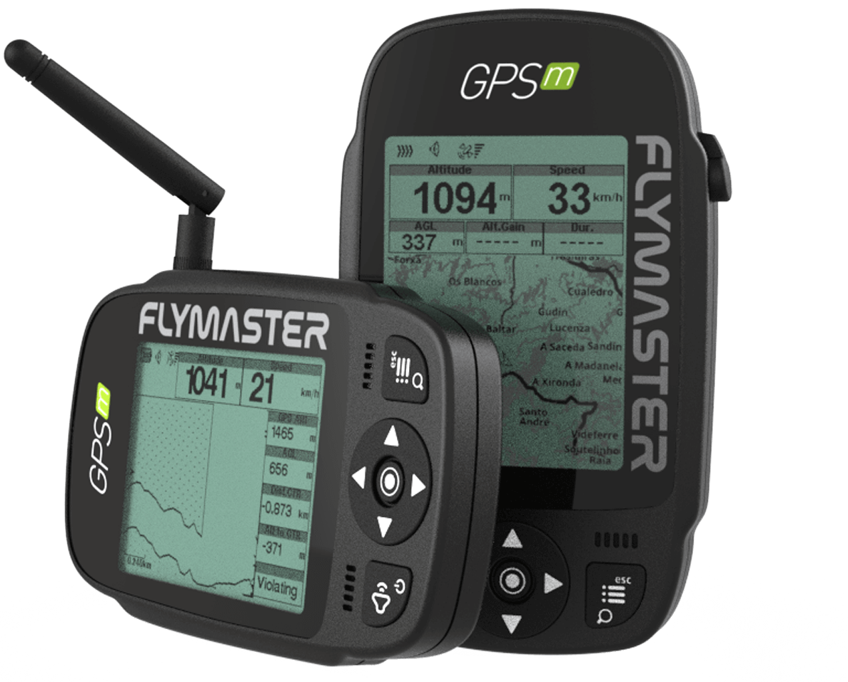
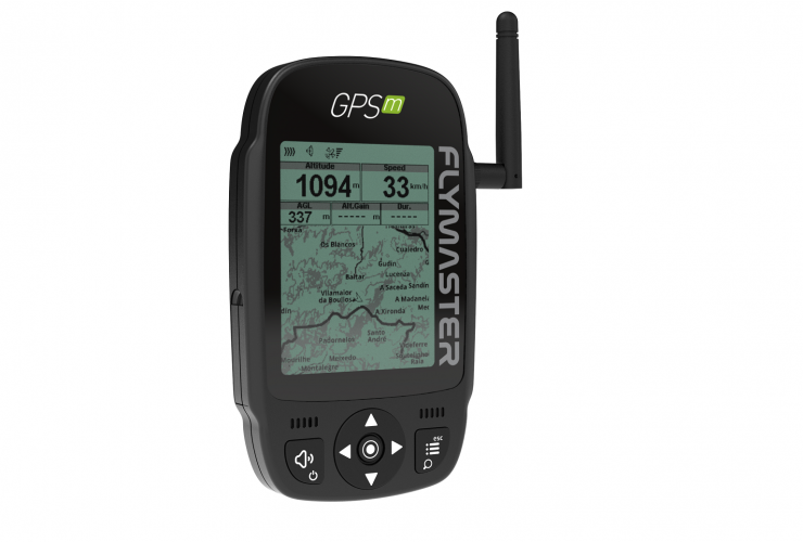
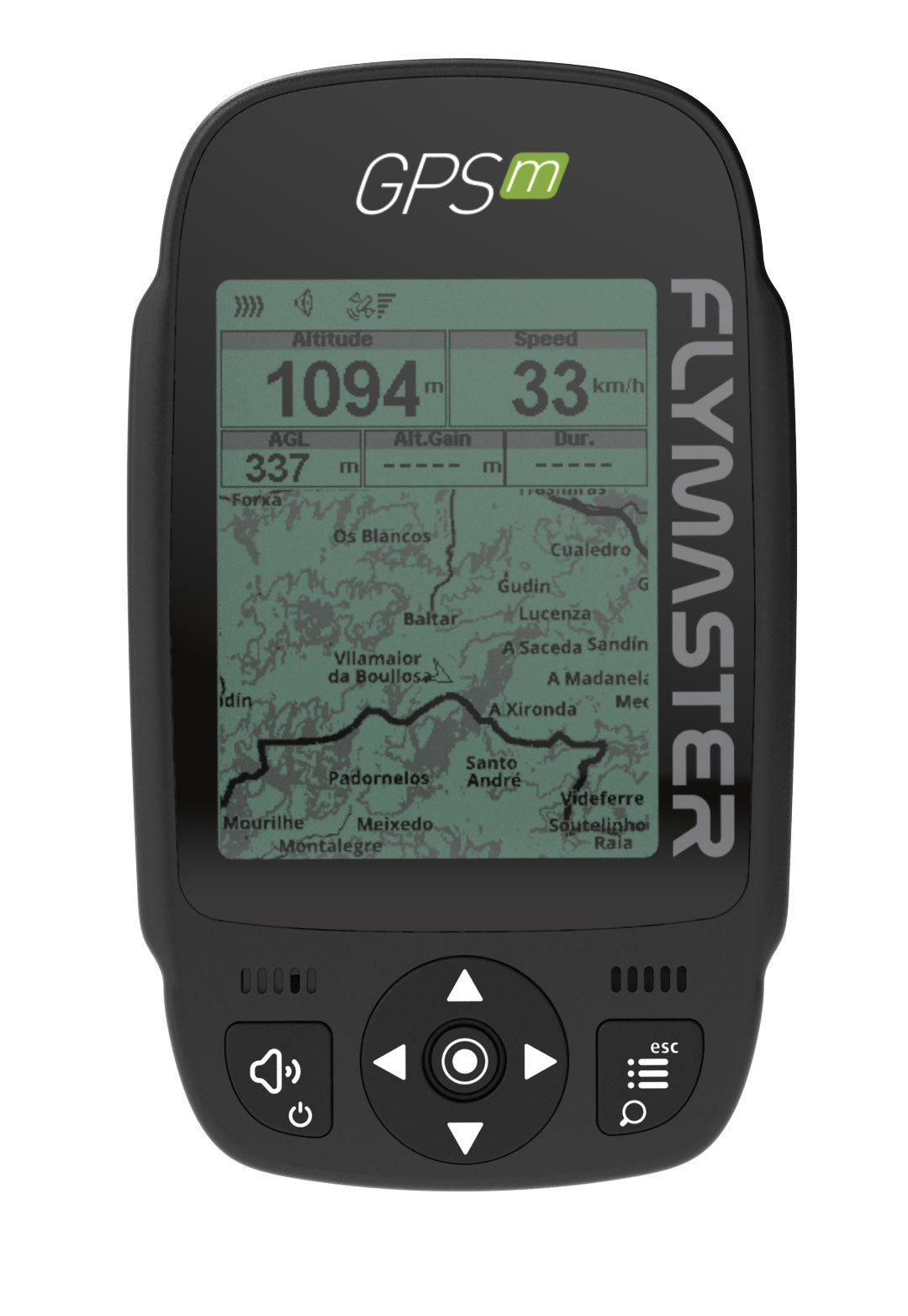
The VARIO M is the ultimate flight instrument specially built for pilots who do not need navigation functions.
- Better build and sturdiness
- More modular build
- Easier reparability
- Better visibility under direct sunlight (display much closer to the protective lens)
- New User Interface
- USB type C
- New landscape mode
- Bigger fonts in landscape mode
- Optional bumper case
- New buttons for better usability with gloves
- Altitude graph in instrument's flight log
- Works with Flymaster Instrument Manager Software
- Import layouts from instrument
| Configurable graphical elements (depending of the element several parameters can be set by the user ex. Size, Border, …) | 11 |
| Configurable data field elements (User can change size, border, title, Font, ...) | 61 |
| Page Trigger Events (page switches automatically if a specific event occurs) |
|
| Multi lingual interface |
|
| Configurable audible alerts |
|
Variometer/Altimeter Features
- Buzzer/near thermal sound.
- Ultra sensitive Variometer with 10 readings per second and 10 cm resolution.
- Configurable vario digital filter and integration values.
- Fully configurable Vario Sound (frequency, increments, frequency/vertical speed relation,….).
- 6 Sound Levels (configurable by menu, or using a key).
- Automatic mute, keeps vario silent until takeoff.
- Altitude adjustment using QNH.
- Automatic altitude adjustment from GPS.
- 2 independent altimeters.
Memory Features
- 3D flight logger IGC format.
- Storage for >300000 track points.
- Up to 248 flights.
- 448 Waypoints.
3D Airspace
- Compatibility with Open Air format (upload of files using Designer).
- Display of restricted areas in map
- Adjustable warning vertical distance to a restriced area
- Adjustable warning horizontal distance to a restriced area
- Display of shortest Vertical, and Horizontal, distance to restricted area
- Resctrited area alarms (Altitude imminent, Position imminent, Violation, …)
- Critical Airspace page (displays information about areas that are closer than a defined distance)
- Worldwide Airspace database (SD card required).
Cross Country Features
- Exclusive Thermal Ball indicator
- Several specific data fields like Distance to take off, current and average glide ratio, average speed, etc.
- Distance to last thermal indexed with altitude
- Go to waypoint
- Multiple waypoint route
- Wind Speed and Direction (GPS based calculations)
- Automatic altitude gain profiler
- Nearby Landings (Displays Required Glide Ratio and distance to all the Landings which can be reached)
Route Features
- Several Glides Ratios (average, to next,…)
- Easy route definition
- Route Navigation, configurable safety/risk margin on turn points.
- Route Map (trace with thermal indication)
Interfacing
- Compatible with MacOS (10.13 and higher), Windows (8/10/11)

0
Total items
€0,00
Taxes included. Discounts and shipping calculated at checkout.
Product subtotal